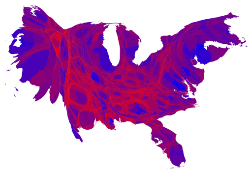
Lots of maps were generated to display the outcome of the 2012 election. Here's one that shows the national map adjusted for county size and in gradations between solid red and solid blue to show the percentage of the vote each party's candidate received. Can you spot Harris County?
Here are links to more.
-
Mark Newman.
-
The Monkey Cage.
-
TPM.
