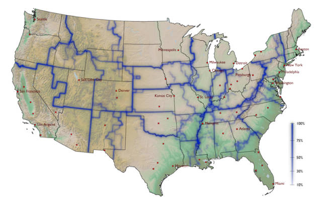
Money spent in one area does not necessarily cross the blue lines - notable the dark blue lines.
Regarding Texas, notice how El Paso is off on its own, but all other metropolitan areas in the state are interconnected. And only minimal barriers exist between Houston and the rest of the Gulf Coast. And we don't seem to engage much with Oklahoma do we?
It would be interesting to add to this the direction of this interchange Currency exchange is not a two way street.